


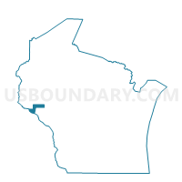
STOCKHOLM - T 1 Voting District, Pepin County, Wisconsin
About
Outline

Summary
| Unique Area Identifier | 696093 |
| Name | STOCKHOLM - T 1 Voting District |
| County | Pepin County |
| State | Wisconsin |
| Area (square miles) | 21.78 |
| Land Area (square miles) | 15.31 |
| Water Area (square miles) | 6.46 |
| % of Land Area | 70.32 |
| % of Water Area | 29.68 |
| Latitude of the Internal Point | 44.50432370 |
| Longtitude of the Internal Point | -92.25750730 |
Maps


Graphs
Select a template below for downloading or customizing gragh for STOCKHOLM - T 1 Voting District, Pepin County, Wisconsin


Neighbors
Neighoring Voting District (by Name) Neighboring Voting District on the Map
- Florence Twp. Voting District, Goodhue County, MN
- Lake Twp. Voting District, Wabasha County, MN
- MAIDEN ROCK - T 1 Voting District, Pierce County, WI
- PEPIN - T 1 Voting District, Pepin County, WI
- Stockholm - V 1 Voting District, Pepin County, WI
Top 10 Neighboring County Subdivision (by Population) Neighboring County Subdivision on the Map
- Florence township, Goodhue County, MN (1,581)
- Pepin town, Pepin County, WI (721)
- Maiden Rock town, Pierce County, WI (589)
- Lake township, Wabasha County, MN (442)
- Stockholm town, Pepin County, WI (197)
- Stockholm village, Pepin County, WI (66)
Top 10 Neighboring Place (by Population) Neighboring Place on the Map
Top 10 Neighboring Unified School District (by Population) Neighboring Unified School District on the Map
- Ellsworth Community School District, WI (11,180)
- Lake City Public School District, MN (8,831)
- Pepin Area School District, WI (2,023)
Top 10 Neighboring State Legislative District Lower Chamber (by Population) Neighboring State Legislative District Lower Chamber on the Map
Top 10 Neighboring State Legislative District Upper Chamber (by Population) Neighboring State Legislative District Upper Chamber on the Map
Top 10 Neighboring 111th Congressional District (by Population) Neighboring 111th Congressional District on the Map
- Congressional District 2, MN (732,515)
- Congressional District 3, WI (729,957)
- Congressional District 1, MN (644,787)
Top 10 Neighboring Census Tract (by Population) Neighboring Census Tract on the Map
- Census Tract 4903, Wabasha County, MN (4,055)
- Census Tract 803, Goodhue County, MN (3,998)
- Census Tract 9608, Pierce County, WI (3,698)
- Census Tract 9502, Pepin County, WI (3,418)